During my recent 2-week trip to Ecuador, I had the opportunity to photograph the Andes, the coast, and the capital, Quito, as part of Visit Ecuador’s Feel Again Project. It was a revelation to discover the two contrasting landscapes and the historical city centre.
The Andes, which I have explored through Chile, Argentina, Bolivia, and Peru still surprised me. In Ecuador, the sheer size of the mountains is impressive. From Quito, the Andes stretch in every direction and the towering volcanic summits like Cayambe and Cotopaxi are omnipresent. The Coast, on the other hand, was more diverse than expected. There were white sand beaches, interesting coastal rocks, and occasional cloud forests.
Adding the two regions together, coupled with a few days in Quito, provided a well-rounded look at the Andean country. No sooner had I boarded my flight back to Canada than I promised I would soon return to explore the country more. For now, here’s my photographer’s guide to Ecuador.
Quito and its nearby mountains
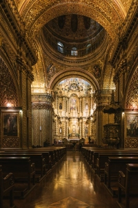
La Ronda – Quito’s Historical Centre
Quito, Ecuador, is the nation’s capital and second largest city. Because the entire city is set in a single valley, it sprawls north and south while remaining relatively narrow east to west. During my visit, I explored a few neighbourhoods, like La Mariscal and La Paz, but La Ronda was the absolute best in terms of photography. As the historical downtown, La Ronda is home to cobbled streets, stunning cathedrals, and government buildings.
Drive Time: La Ronda is in central Quito, travel time varies | Recommended time: Blue hour, 30 minutes after sunset.

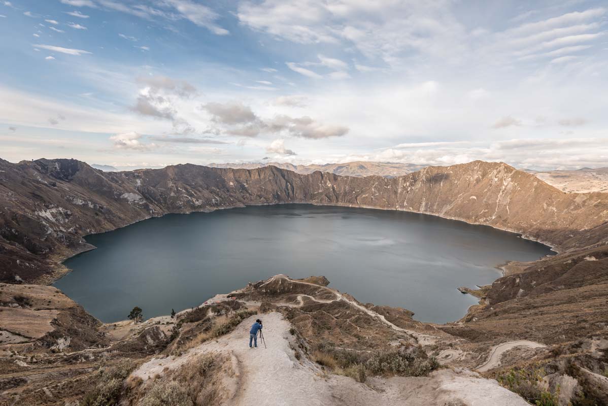
Laguna Del Quilotoa
Not unlike Crater Lake, in Oregon, Laguna del Quilotoa is a stunning caldera lake near both Cotopaxi and the Ilinezas Volcanoes. Located 160 km south of Quito, it makes for an easy out-and-back day trip; however, I would only recommend it if you have more than a single day in Quito.
Drive time: 5 hours, return from Quito | Recommended time: Ideal at sunset.
Cayambe Volcano
Throughout my entire stay in Ecuador, the number one item on my photography list was to photograph the many volcanoes that surround Quito. Sadly, I never had a clear view of Cotopaxi, which has been erupting since late August 2015, but on my final nights in the country, I had stunning views of Cayambe straight off my hotel balcony.
Drive Time: Hotel Quito is located in the La Paz neighbourhood, travel time varies | Recommended Time: Sunrise or blue hour

The Ecuador Coast
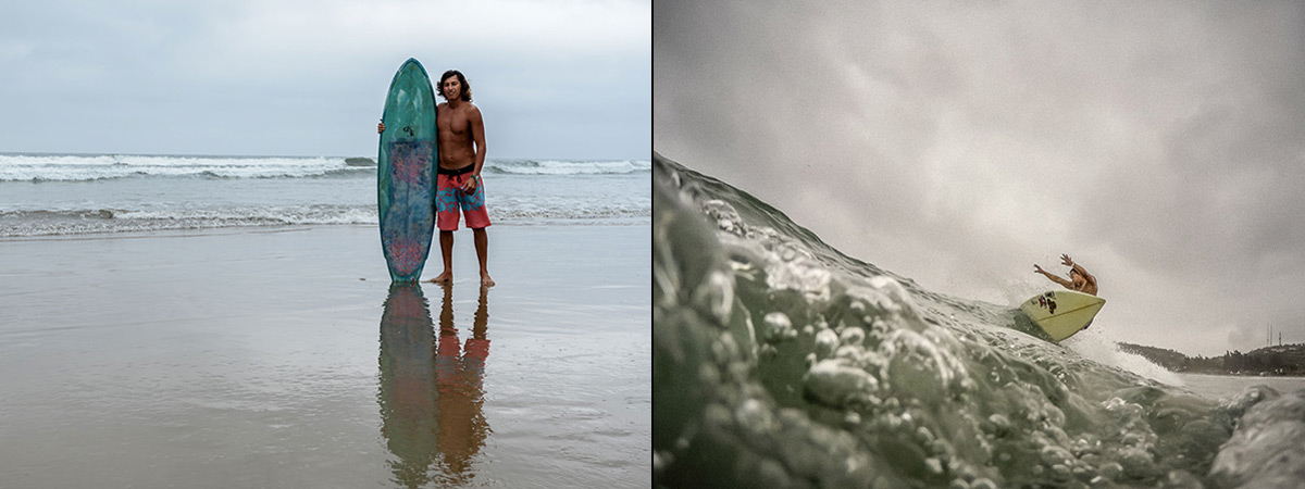
Montañita – Ecuador’s best surf town
Surf culture is alive and well on the coast of Ecuador and no town shows it off quite like Montañita. While local life remains tied to the swells, the town itself has a reputation as a backpacker’s party stop along the gringo trail.
Drive time: 3Hrs north of Guayaquil | Recommended Times: the best light is in the AM, but the best surf is in the PM.
Las Tanusas Resort and Spa
Las Tanusas isn’t just a stunning resort and spa. It’s also a killer seascape photography location thanks to a diverse coastline. While the interesting rock formations caught my eye most, there were also white sand beaches lined with palm trees. It’s also a prime spot to watch for humpback whales migrating down the coast.
Drive Time: 2:45 hrs north of Guayaquil, 1 hr south of Manta | Recommended time: Sunset

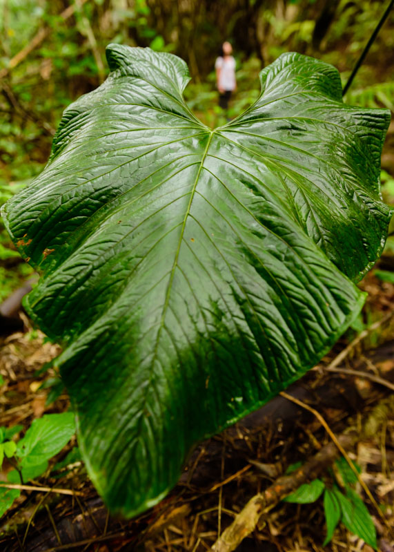
Pacoche Reserve and Lodge
Wildlife photographers with more patience and better luck than I had are likely to see howler monkeys in the Pacoche Reserve, along with 55 endemic bird species.
Driving Time: 3 hrs north of Guayaquil or 30 minutes south of Manta | Recommended Time: Early morning

Puerto Del Morro Mangrove
Located just west of Guayaquil, the Puerto Del Morrow Mangrove is one of the best places to see dolphins in Ecuador. Boat tours leave hourly and travel through mangrove forests in search of dolphins. The only down side to the tour is if you fail to see dolphins in the mangrove, the tour winds up in the fishing port near Posorja, where sightings are more likely but the scenery is awful.
Drive time: 1 Hr west of Guayaquil | Recommended Time: Sunset tour

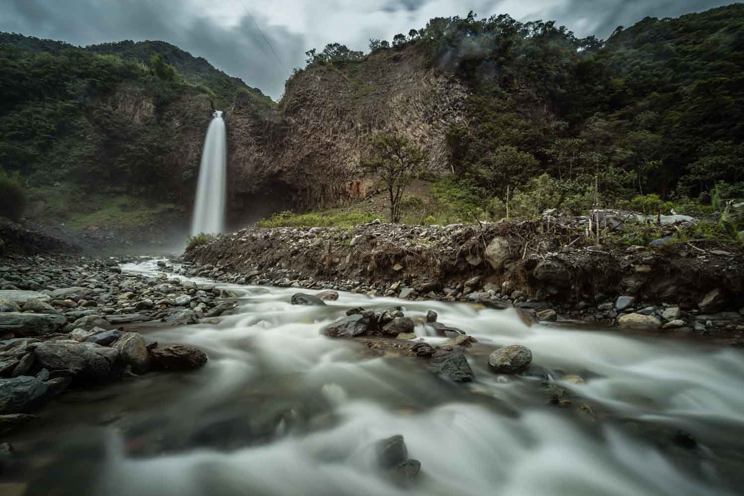
Baños de Agua Santa
Waterfalls Road
Baños de Agua Santa, best known as Baños, biggest attraction is the 15-km long Waterfall Road. It’s a common cycle route for backpackers; however, as a photographer hauling a full camera kit I was thankful to explore both Manto de la Novia and Pailon del Diablo by car.
Drive Time: 15 minutes from Baños | Recommended time: early morning, before the crowds.

Casa del Arbol
If the waterfalls are Baños’ biggest attractions, the most touristy thing is the Casa Del Arbol Swing. It’s little more than a photo opportunity, but two giant rope swings let visitors pay $1 for the chance to swing out under the Tungurahua volcano. It’s a cheap thrill and a killer photo, especially when the clouds aren’t blocking the view.
Drive time: 30 minutes by city bus, 15 minutes by taxi | Recommended time: early morning, before the crowds

The Antennas
Across the valley from town, a wickedly steep road climbs towards a set of radio antennas. The drive – made possible by inexpensive ATV rentals in town – makes for the perfect sunset photography location, as the panoramic view takes in the entire valley, the town, and the Tungurahua Volcano.
Drive Time: 20 minutes | Recommended time: Sunset
Bonus: Galapagos Islands
My friend, and fellow canadian travel photographer Brendan Van Son joined Team USA in the Galapagos Islands during the Feel Again campaign. After a quick glance at his images, I’d say that the Galapagos are a wildlife photographers dream, that Brendan lucked into some terrific light, and that he owes me an a really awesome Christmas present. Anyway, check out his images and his recommended packing list for the Galapagos if your trip to Ecuador includes a trip to these amazing Pacific Islands.
Go beyond my Photographer’s Guide to Ecuador
This Photographer’s Guide to Ecuador is part of a series developed in partnership with Ecuador Travel. Watch for these upcoming posts:
- Feel Again in Ecuador – October Desktop Wallpapers
- 21 Ways to Feel Again on the Ecuador Coast
- Feel Again Project Adventures
- Feel Again in Ecuador Video Launch
wow, you did all this in two weeks. I was in Ecuador for 5 weeks and barely scratched the surface, Do you jump in and out of a vehicle, snap a photo and move on? Montanita might be Ecuador’s best surf town, but your photo does not reflect what I saw – a beach covered with garbage and empty beer bottles. I spend a week there, a lovely place if it wasn’t covered with garbage,everywhere, put there by partiers and surfers.
hey! We did plenty of jumping in and out of cars, but we were there for this photography purpose while working for Visit Ecuador on their Feel Again Project. I really wanted to slow down to do some hiking and cycling, but it’ll have to be on another trip in the future.
Sucks to hear that the beach was covered in garbage and beer bottles. I can honestly say that wasn’t the case when we were there. It was cleaned up nicely. The whole town looked good, except for the lake/lagoon that thankfully doesn’t quite reach the beach.
Lovely photography! I am fortunate to live in Ecuador and have fallen in love with the epic scenery and the kind people. I had not heard about the Feel Again Project… will be reading more to find out what it is all about.
Jeff – this is a great post, I have wanted to visit Ecuador and was not sure were to start planning it. It’s cool to see it from the perspective of a photographer as well – since I aspire to get great pictures when I travel 🙂